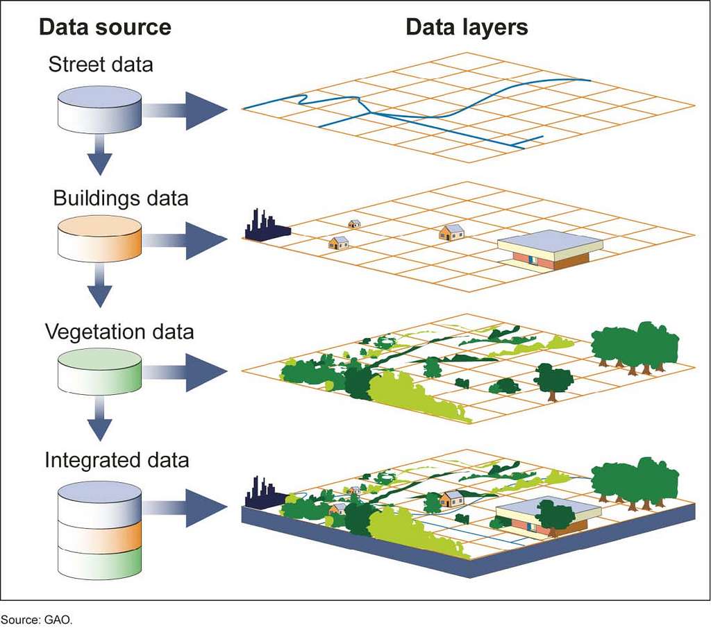
GIS
Geographic Information Systems (GIS) are tools used to help us understand spatial relationships and patterns and to visualize these data on maps. GIS tools provide a broad framework to allow users to capture, store, analyze, and display spatial or geographic data and make it accessible to a wide audience. GIS is a huge field of study, so it can be daunting to learn in the beginning. Use these tools to guide you and if you need more help, please email data@reed or consider visiting the DataLab.
Reed primarily uses QGIS but we also support ArcGIS. Learn more.
A brief guide to why your points are in the middle of the ocean.
Short tutorials to teach you how to load data, change map colors, crop to layer overlays, and more. (This is a work in progress and more will be coming soon!)
Know what you want to do but can't remember the tool name? Look here!
Resources & Where to Find Data
A list of resources for learning QGIS and finding data files